The island of Lanzarote lies just 125 kilometres off Africa’s Saharan Coast and is the most easterly of the Canary Islands (Spain). The island is 60km long and 20 km wide, making it the fourth largest island in the Archipelago. One of the first things that visitors notice is that nearly all of the buildings are white – this is largely thanks to the work of local artist, César Manrique, who worked tirelessly to protect the island’s traditional architectural style and avoid over-development. Houses had to be white coloured and the front door should always be brown or green. But close to the sea the front door could be blue as well. Very charming!
Lanzarote has a subtropical desert climate with average daytime temperatures ranging from about 21°C in January to 29°C in August. The island has just 18 days of rain per year on average, making it a very popular destination for sun-seekers.
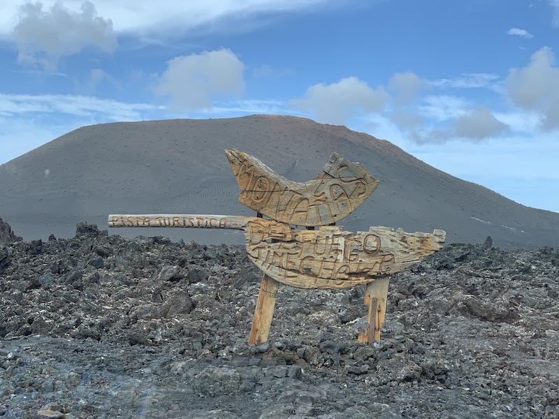
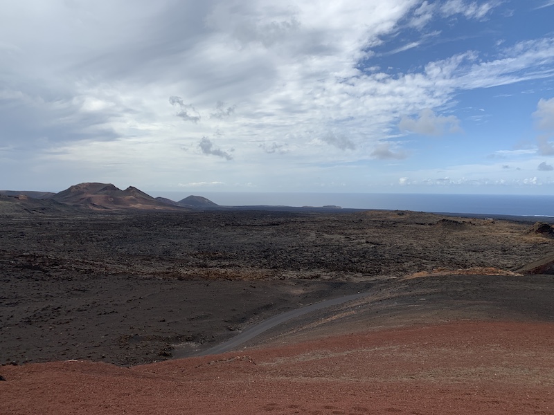
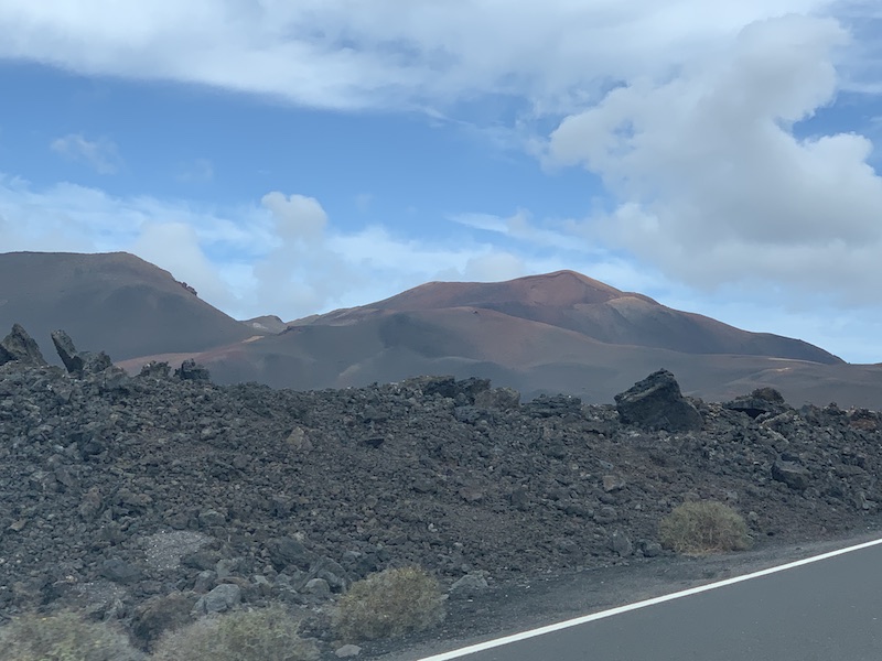
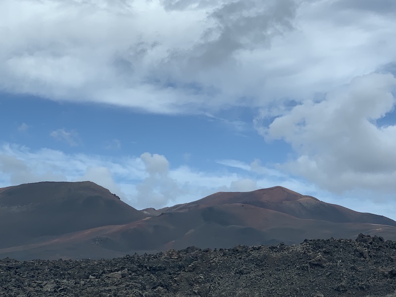
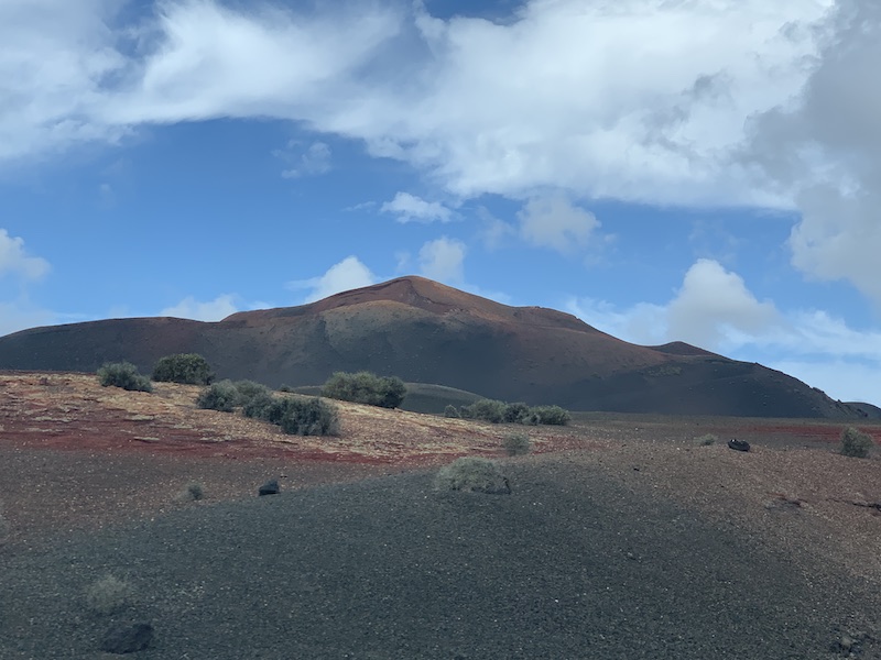
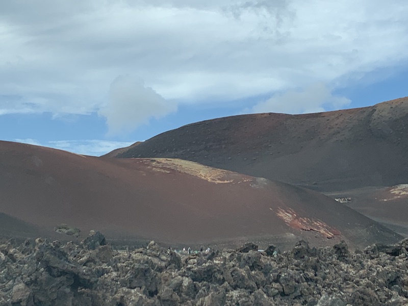
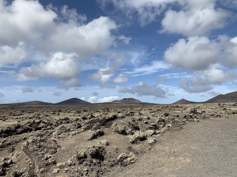
Large areas of the island are dominated by volcanic scenery; the spectacular Montañas del Fuego were created during the eruptions that took place between 1730 and 1736 when over 100 volcanoes erupted and devastating a large part of the South-west of the island. Even today, temperatures just below the surface reach over 400°C. Many of Lanzarote’s most popular tourist attractions are also volcanic in origin, including El Golfo (a flooded and partially eroded volcanic crater) and Jameos del Agua (part of one the World’s longest volcanic caves).
We hired a car for 2 days. It is also possible to contract a taxi driver for half a day or a full day. The first day we drove to the SW part of the island, the Vulcanic part. And the next day we went North. 2 Totally different sceneries and views!
SOUTHWEST LANZAROTE
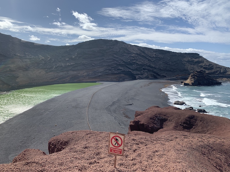
El Golfo
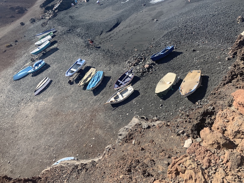
We drove from Arrecife via Yaiza to El Golfo. El Golfo is a natural example of the power of Mother Nature. El Golfo is a half-submerged cone of a volcano, which over time has been eroded by the sea, leaving behind only the striated wall of the crater displaying a myriad of red and russet colours. At the foot of the crater wall is Lago Verde, a half-moon-shaped striking green lagoon filled with volcanic minerals and micro-organisms that are believed to be unique in this lake. A beach of black volcanic pebbles, where you can look for specimens of the semi-precious olivine, superficially separates the sharply contrasting lagoon from the blue waters of the Atlantic Ocean, but in reality they are connected through underground passageways. Coming from the south, the road leads you to a small car park, from where you can approach El Golfo by foot, following signs for a short walk around the headland. A number of sheltered bays with black beaches link the lagoon with the tranquil El Golfo village, which attracts geologists and jewellery makers because of the olivine found in this area.


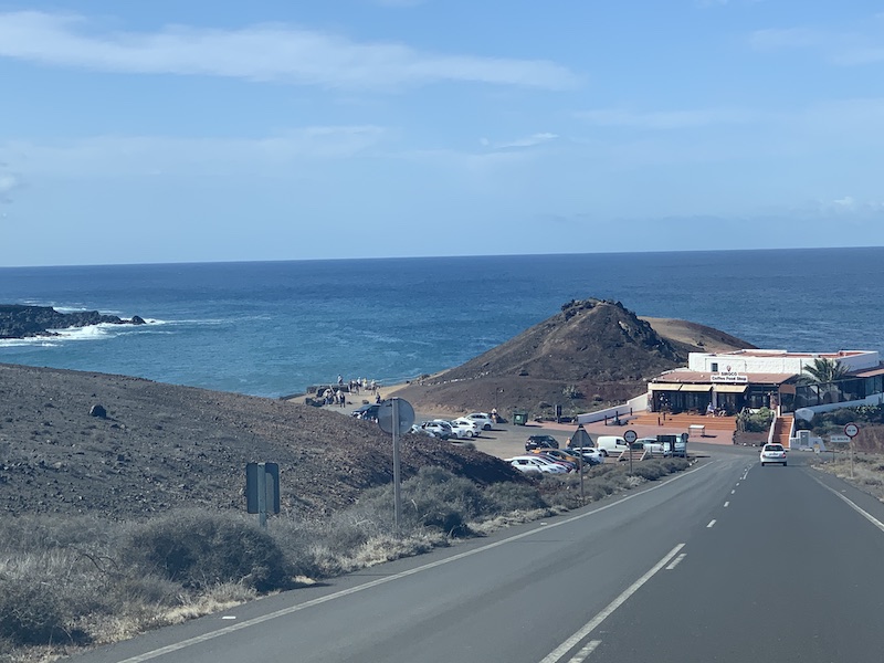
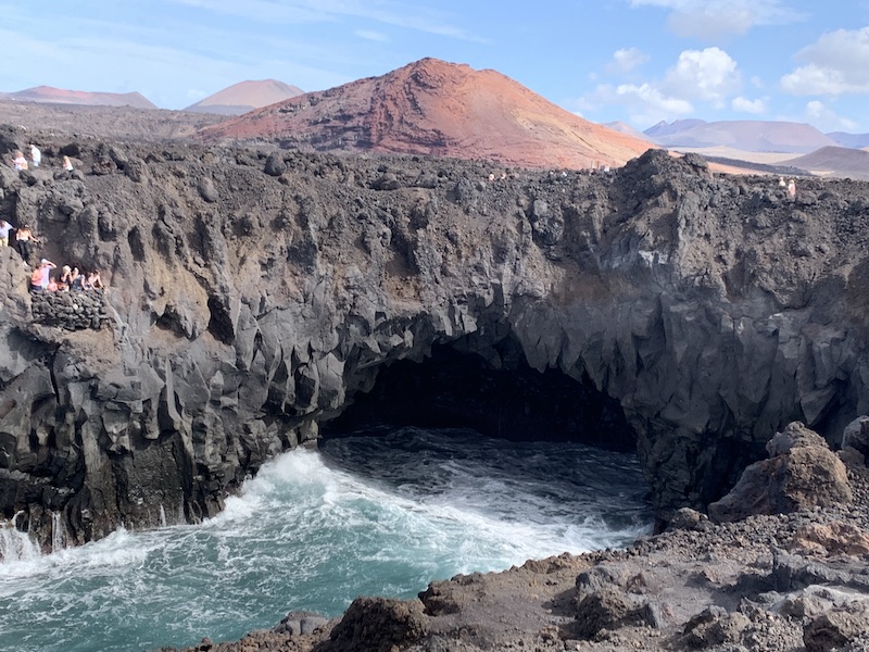
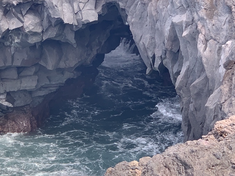
Los Hervideros
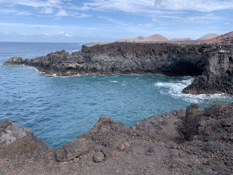
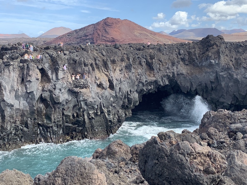
If you drive from El Golfo southwards to the salt pans of Lanzarote (Salinas de Janubio) you will pass Los Hervideros. This natural phenomenon shows what the elements of nature can achieve together. Lava flows have created a rugged rock formation that stops very abruptly where the sea begins. Here you can see how the sea has snapped pieces from the coast and how the waves crash into the rocks.
Walking paths and viewing platforms have been created between the rocks. This gives you a wonderful view of the foaming heads of the seawater that are chased through the cracks and holes of the rocks. Certainly if the sea is rougher, this is done with enormous force. You not only see it, but you hear how the sea tries to make its way through the holes and crevasses of the lava rock. Unfortunately, you are never alone here, so you often have to deal with environmental noise from other people. As a result, the experience unfortunately loses some of its power.
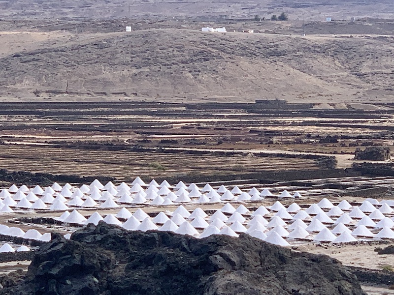
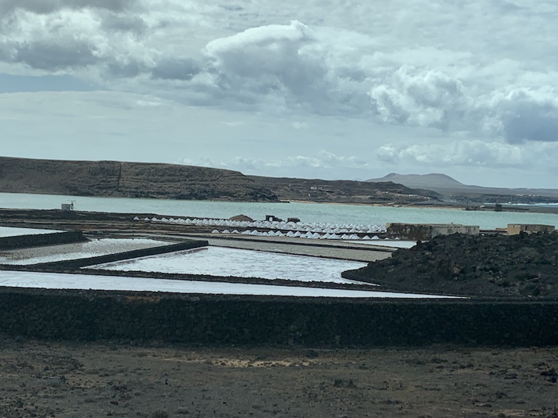
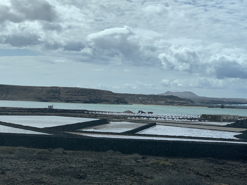
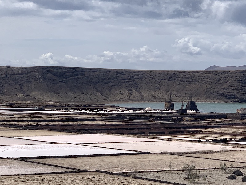
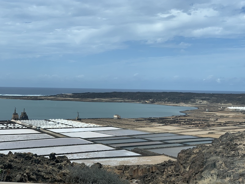
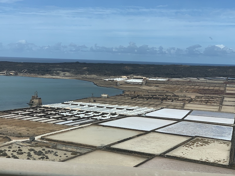
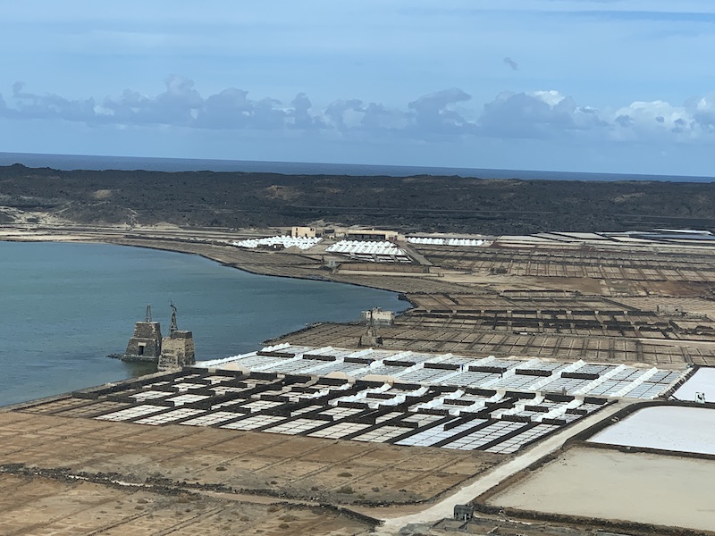
Salinas de Janubio
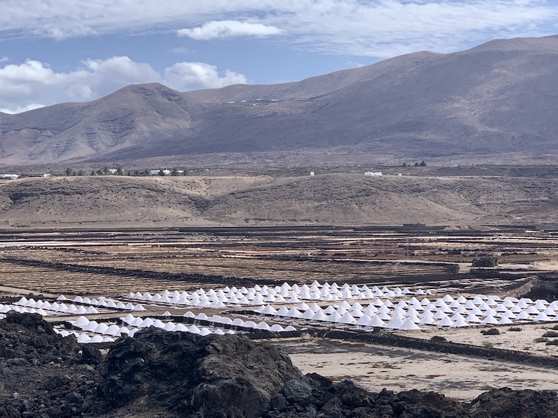
The Salinas de Janubio form the largest salt extraction area of the Spanish archipelago Canary Islands. The lagoon, which is no more than three meters deep, was created by volcanic activity. A natural headland separates the lagoon from the Atlantic Ocean. Agriculture was initially conducted in the area. In 1895 the construction of salt extraction facilities was started. The area is approximately 45 hectares. Up to the 70s of the twentieth century, around 10,000 tons of sea salt were extracted here each year. The salt was mainly used for salting fish. However, due to declining catch quotas, the ever-improving cooling technology and international competition, the demand for sea salt declined dramatically. Currently only one fifth of the original area is actively used. About ten salt farmers are responsible for extracting around 2,000 tonnes of salt per year. Part of this salt is still used for preserving fish. Another part is used as a chlorine replacement in swimming pools, or sold as table salt. Along the LZ-703 there are various viewpoints on these salt fields. There is also a ‘bodega’ where they sell the salt and other salt related products.
Playa Blanca and Marina Rubicon
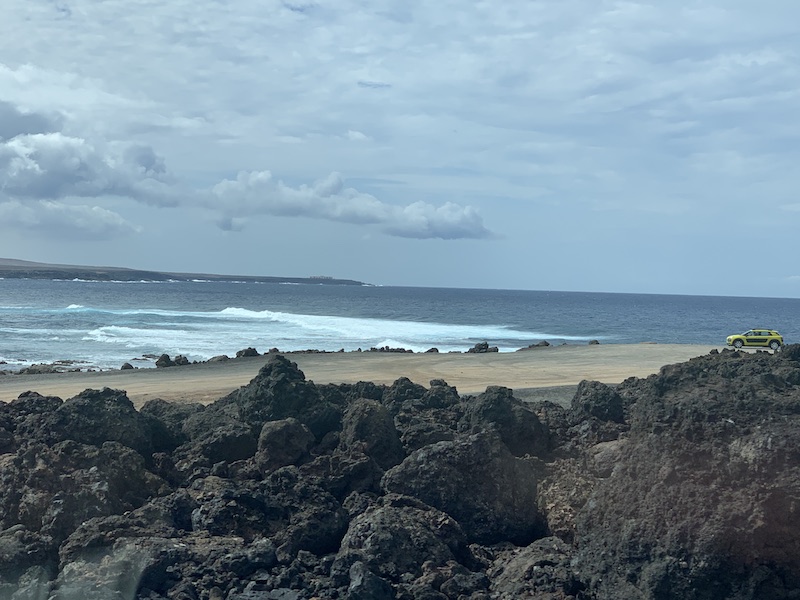
Playa Blanca is the most southerly part the island. Approximately 37 kilometres from the island’s capital Arrecife and some 33 kilometres from the Airport. Playa Blanca is the fastest growing tourist resort on Lanzarote. Until quite recently, Playa Blanca was a small fishing village somewhat stranded at the bottom end of Lanzarote. The fact that there was a bustling port where you catch the ferry to Fuerteventura meant it was always a popular place, ripe for development. The coastline around Playa Blanca is essentially one large 9 kilometre wide bay which is then broken up into three smaller, but still large, bays. This basic geography means that the beaches in and around Playa Blanca are sheltered and ideal for swimming and sunbathing.
Playa Blanca has two ports. The commercially most important port is the main port: Puerto Playa Blanca. This is located in the centre of the place. The ferry to Fuerteventura, among others, departs from here. If you want a day trip to Fuerteventura: the crossing takes less than half an hour and if you want, you can take your rental car with you. The most beautiful beaches of Fuerteventura are a fifteen-minute drive from the port of Corralejo, where you arrive at Fuerteventura. The most attractive harbour for tourists is Puerto Deportivo Marina Rubicón. In addition to berths for yachts and boats, this marina also offers a number of attractive restaurants and shops.
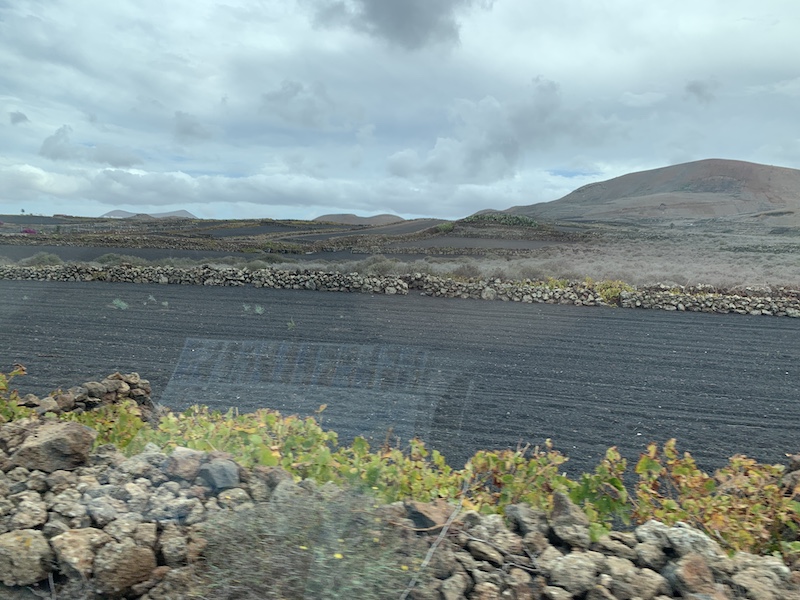
The island of Lanzarote is very small and the distances are very short. The island is very very very clean! You hardly see any rubbish along the highways or in the small towns. They use the lava stones, which can be found everywhere on the island, for all kind of things. For building houses, for separation walls or for walls along the roads.
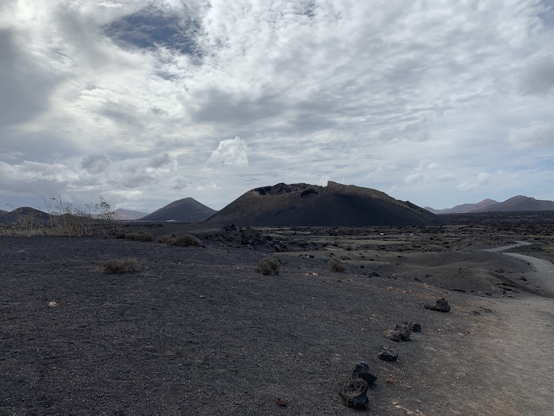
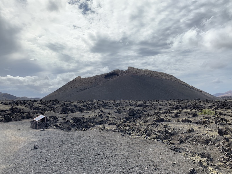
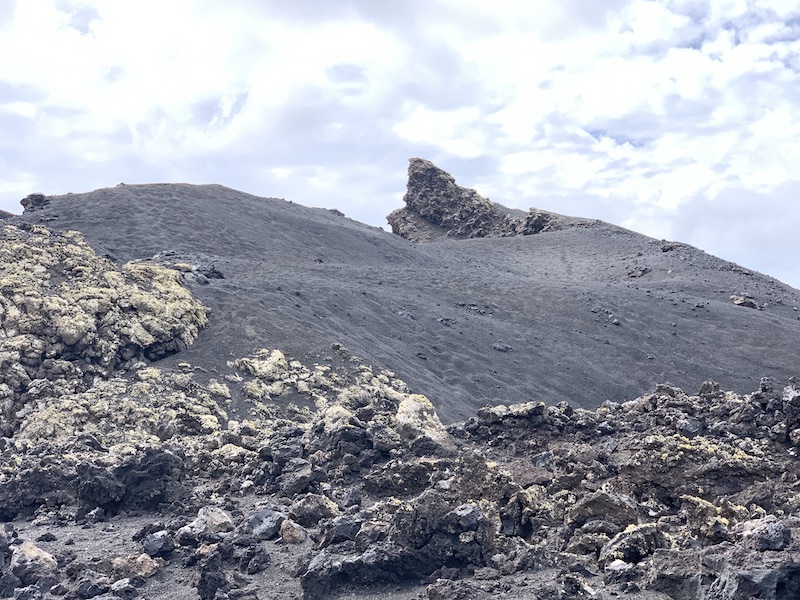
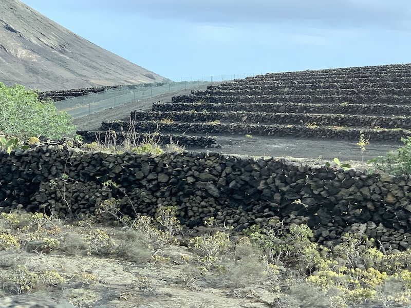
After having seen all these attractions above it was only around midday. We drove back in Northerly direction to the Fire Mountains to visit the Timanfaya National Park. A visit to the Timanfaya National Park is a must for every visitor to Lanzarote. The spectacular volcanic landscape, that covers a quarter of the island, was created over six years of near-continuous volcanic eruptions that took place between 1730 and 1736, with a smaller episode in 1824. The scale of the eruptions was enormous, with an estimated 2,000,000,000m3 of lava spewed out from more than 100 volcanoes onto previously-fertile land and villages, as well as reclaiming some new land from the sea. Although the majority of the eruptions took place nearly 300 years ago, Lanzarote’s dry climate means that the Volcanic landscape is relatively unchanged since that time. Though there were no recorded deaths attributed to the eruptions, it is estimated that more than 44% of the island’s population emigrated during those years, and there are many accounts of livestock being killed by poisonous gases. Yaiza’s parish priest left a written account describing the destruction of villages, terrifying earthquakes, mountains rising up overnight, explosions and raining hot ash. When the eruption finally ended, much of Lanzarote’s most arable land was lost forever under a thick crust of basalt, though in La Geria, the locals soon invented a new form of agriculture, by digging pits in the volcanic ash, allowing vine roots to reach the fertile soil buried underneath.
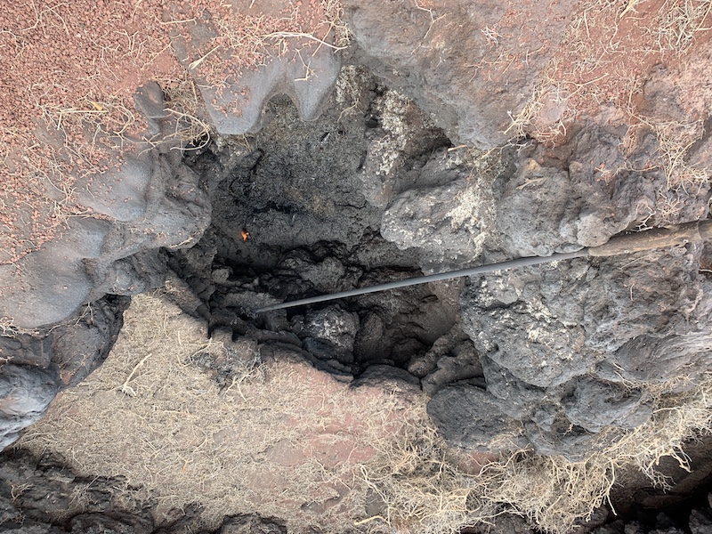
The main Montañas del Fuego (Fire Mountains) Centre at Islote de Hilario offers visitors the chance to experience first-hand the geothermal anomalies present in the area (thought to be caused by a Magma intrusion under the island). Although volcanically dormant, temperatures of up to 610°C have been recorded at a depth of 13 metres, and up to 277°C at just 10cm! You get to witness demonstrations of this intense heat as straw auto-ignites after being dropped into a shallow pit, steam gushes out of the ground moments after being pored into a hole as cold water, and the gravel under your feet is hot enough to burn your hand!
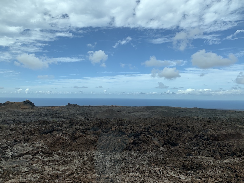
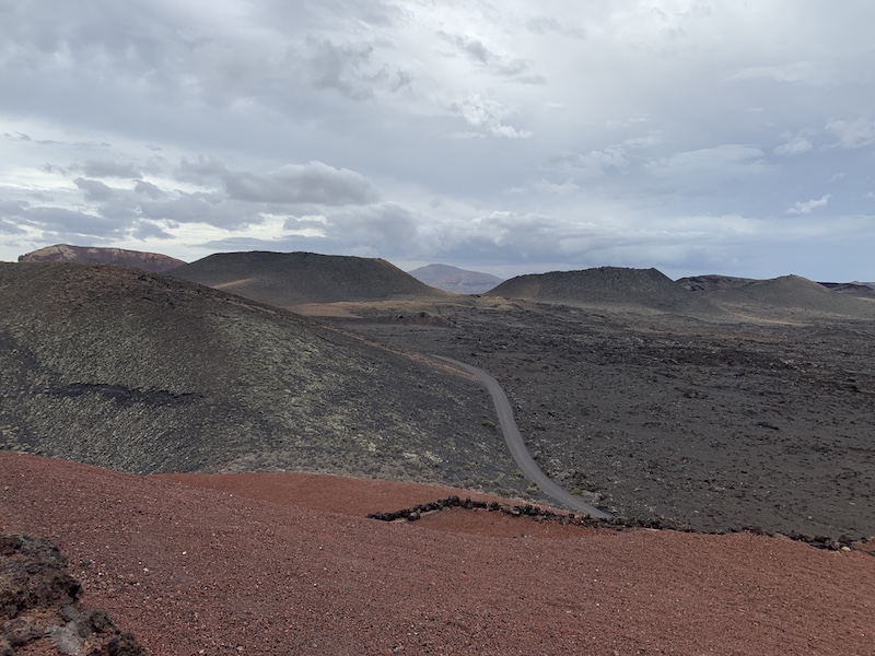

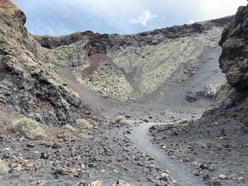
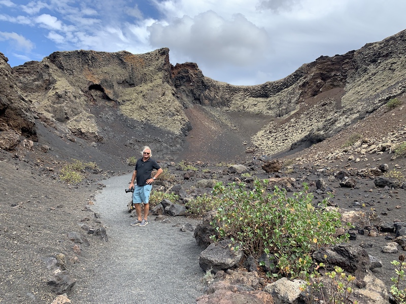
After this exceptional nice visit we continued to the area of La Geria. The winery area. But driving that direction we came along the Parque National Los Volcanes. Here you can walk into a crater! Really nice and worth the walk of about 25 minutes up and 25 minutes back again!
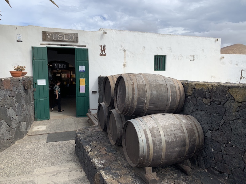
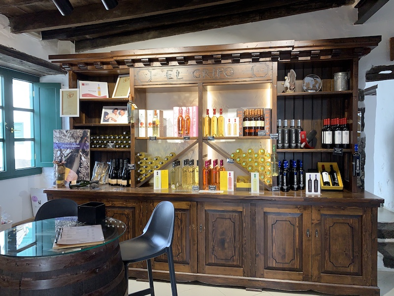
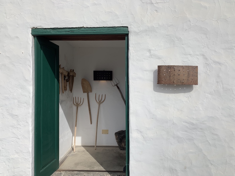
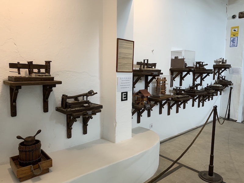
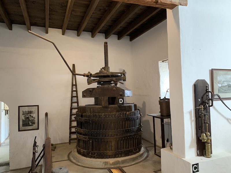
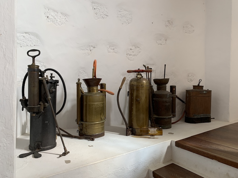
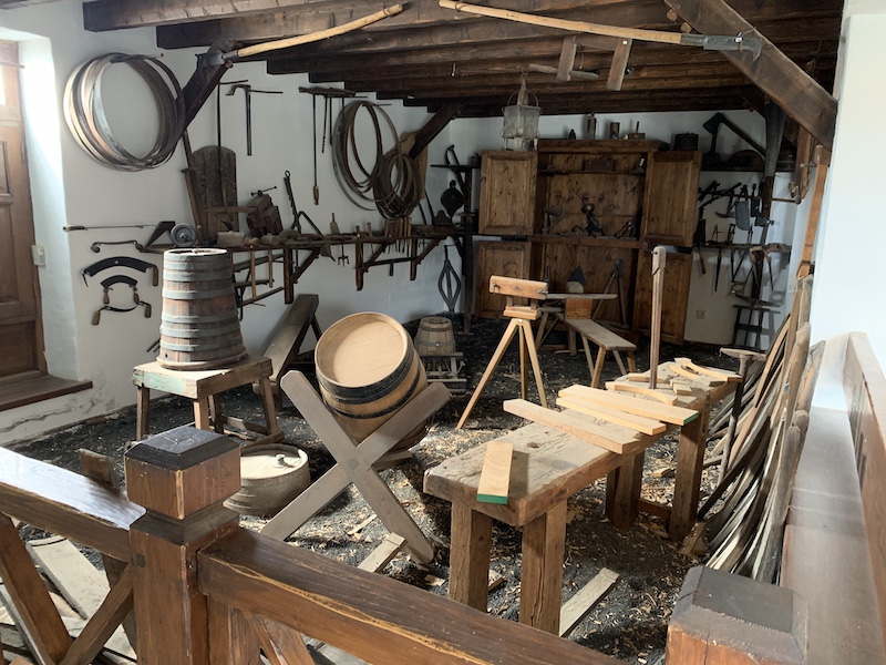
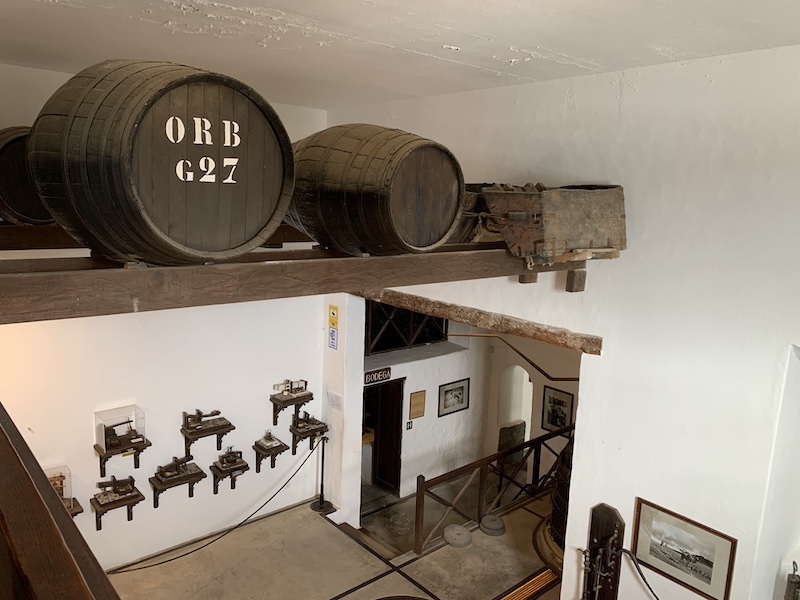
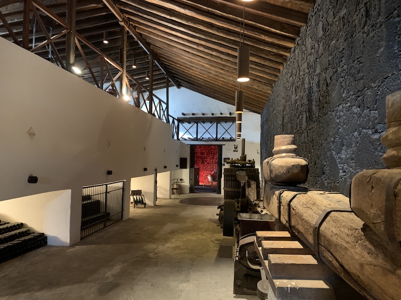
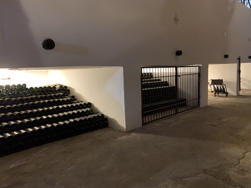
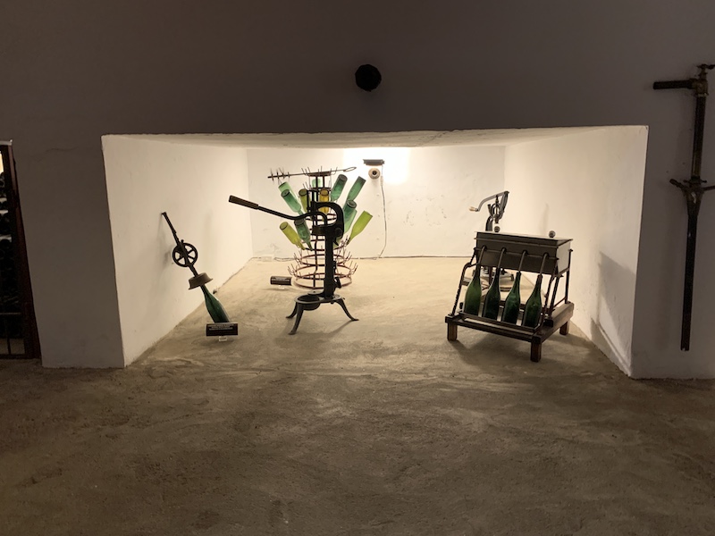
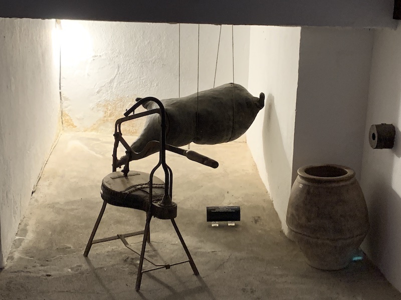
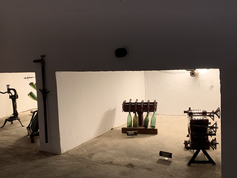
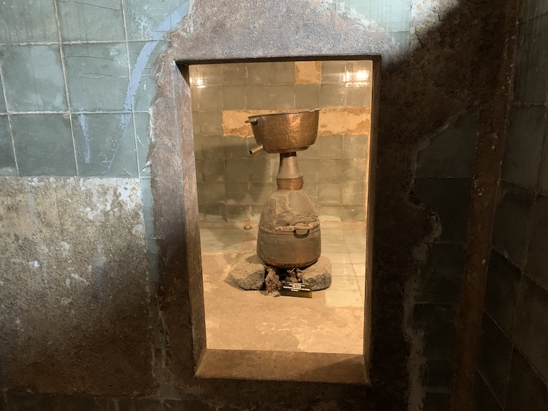
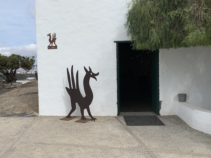
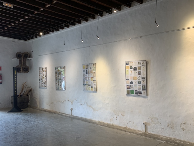
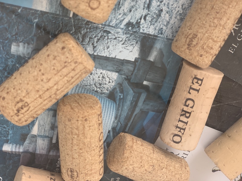
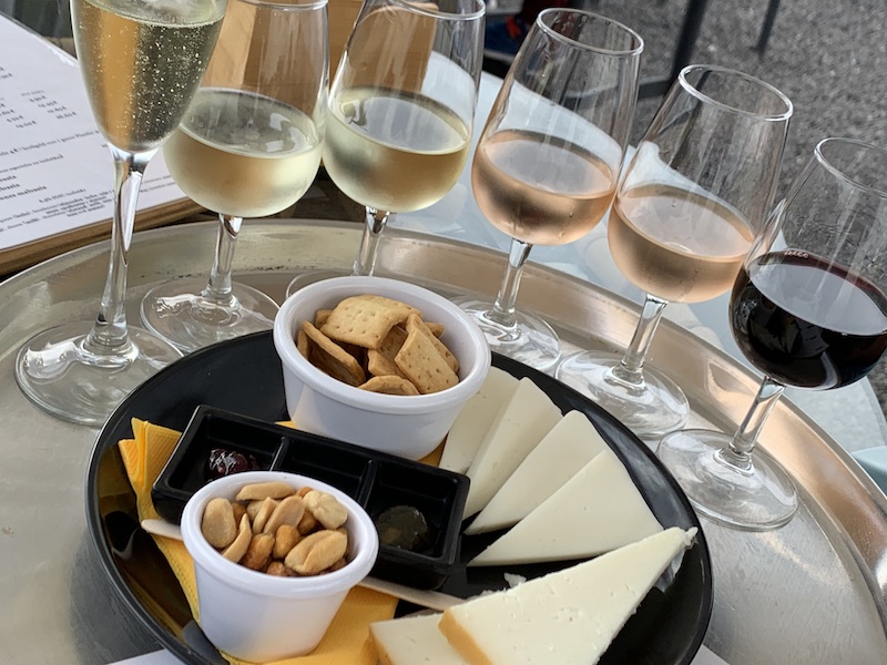
We ended up in a winery! Yesss! I was tired from walking so much and really liked a glass of wine! We visited the winery of El Grifo. We first visited the beautiful museum and we finished our first-day tour with 6 different wines to taste from. It was a great day. And I must say that I was really surprised by the beauty of the island!


Leave A Comment