The Galicia Coast
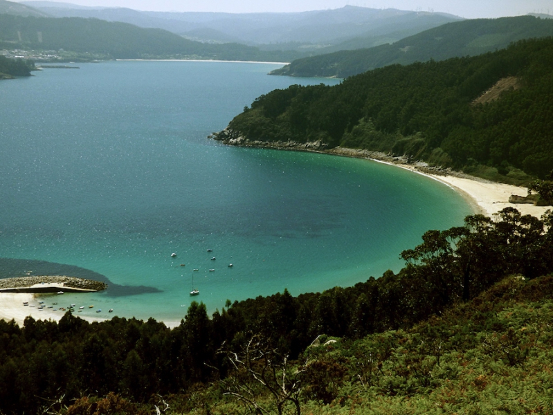
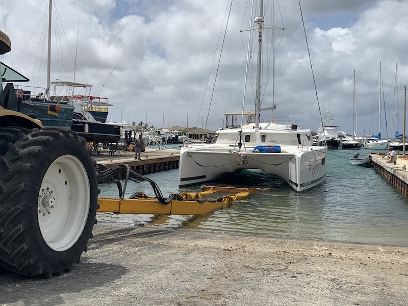
The Galician coast is a major attraction for sailors. Along the 1,300 kilometres of coastline, there are plenty marinas and anchorages available. Sailors in Galicia can choose between the heavy seas of the Atlantic Sea and the peacefulness of the estuaries, sheltered by the coastal mountains. Galicia is a land with deep emotional ties to the sea. Its entire coastline has a special seafaring spirit you find back in the local people and landscapes in the coastal cities and villages. The Galician coast holds several gems, such as Galicia’s Atlantic Islands Maritimal-Land National Park, in the Rías Baixas area. It is a natural paradise with unique flora, birds and fish. The Galician coast is full of bays and inlets which are known locally as “Rias”. Every Ria is fed by at least one estuary and it is the meeting of fresh and salt water. An estuary is a partially enclosed coastal body of brackish water with one or more rivers or streams flowing into it, and with a free connection to the open sea. The coastline looks rugged but on the ground you find picturesque bays and beaches everywhere. Finding a quiet anchorage or isolated beach is never difficult in Galicia.
The upper and the lower Rias
Throughout Spain, Galicia is known as the region of a thousand rivers and most of those rivers vent into estuaries that feed into the sea through the many “Rias” or bays. These “Rias” are split into the “Rias Altas” and the “Rias Baixas”, translating into upper and lower bays or estuaries. At the mid point between the “Altas” and “Baixas” is the famous historic fishing port of “Finisterre”. This mid point also signals a change in the landscape and even the climate, with the upper estuaries being backed by rocky and mountainous hills with sparse vegetation and a medieval “Celtic” feel. The weather also gets cooler, windier and wetter as you head north.By contrast, the bays and shore line below “Finisterre” seem to be shadowed by a softer more cultivated backdrop featuring not just pine and eucalyptus forests, but also fields of crops and a distinctly greener tone to the grassy meadows. The rocky, craggy hills that surround the upper estuaries also soften into more rounded hill tops as you travel further south.


Ria Altas, the upper Estuaries from Ribadeo to Cabo Prioriño
This part of the coast is divided into 2 different types. The first section runs from Ribadeo to Cabo Morás, known as the Gulf of Masma. Sailing this part is normally without any dangers. Around Los Farallóns you can find NW winds, which are very strong in the winter, and NE winds, which are common in the summer with anticyclone conditions. There are seven ports for refuge: Ribadeo, Rinlo, Foz, Burela, San Cibrao, Morás and Portocelo. Only Ribadeo is a marina. If you encounter rough seas, you should seek refuge within the large San Cibrao. It is difficult to access Ribadeo with off-shore waves because of the sand bar shoal. The Ribadeo estuary and the San Cibrao inlet are excellent anchorages.
The second section of coast runs between Cabo Morás and Cabo Prioriño, just before reaching Ferrol. It is characterised by a high, rugged and clear coastline, In general, it is highly exposed to storms out of NW, the most fearsome in this area. In there is a storm, you can tie up at the Viveiro marina or at the fishing ports of Vicedo (O Barqueiro estuary), Espasante or Cariño (Ortigueira estuary) and Cedeira (Cedeira estuary). The Ortigueira port closes at low tide and with groundswells, due to the sand bar shoal, and entry is not recommended if you do not know it well or when sailing at night.
Golfo Ártabro
Ártabro Gulf is located between Cabo Prioriño and A Coruña . The Ferrol, Ares, Betanzos and A Coruña estuaries are located there. The Ferrol and A Coruña estuaries are the safest and easiest to access in case of rough seas. This section of the coast is exposed to winds from the NW which are the most dangerous and common in winter. The A Coruña and Ares estuaries offer everything required for any type of repairs. In the Betanzos estuary, you will find the fishing-mussel harvesting port of Lorbé and all the mussel platforms opposite it.
There are excellent anchorages in Ares and Redes inlets and opposite Cabanas-Pontedeume beach. In the Betanzos estuary, there are good anchorages in Cirno inlet and Bañobre inlet. A Coruña estuary is between Punta Seixo Branco and Punta Herminio. Once inside, there are three marinas Deportiva de A Coruña Marina Coruña, R.C.N. de A Coruña and Nauta Coruña. There are good places to anchor on Mera inlet , which also has a small fishing quay, and near the islet and castle of Santa Cruz.
Costa da Morte
This is the section of coastline that stretches from A Coruña port to Porto do Son in the Ría de Muros e Noia. One of the loveliest and at the same time most dangerous, which has earned it the name Costa da Morte (“Deadly Coast”). There are noy only many rocks but also very large rocks and islets. Reefs that are covered and uncovered (sometimes further from the coast than you would expect), some properly marked and others not. This definetly makes sailing in these waters dangerous, especially when sailing at night. You should always study the charts very carefully and avoid sailing at night.On this stretch of coast there are 2 marinas: Camariñas and Portosín. Other options for shelter in case of need are the fishing ports of Malpica, Laxe, Muxía, Fisterra, Muros and Porto do Son. There are other fishing ports that are not recommended because it is very difficult to enter these.
Ria Braixas, the lower Estuaries
This coastline is regarded by many as a paradise, and it is also the site of the Cíes Islands, known by the Romans as “the islands of the gods”.The Rías Baixas are a series of four estuarine inlets located on the southwestern coast. They are the Ría de Muros e Noia, the Ría de Arousa, the Ría de Pontevedra, and the Ría de Vigo. The capital is the city of Pontevedra.
The west coast of Spain is a really beautiful area. There are so many things to see and do. So take your time to explore the regions. Every Ria has something to offer.

Leave A Comment