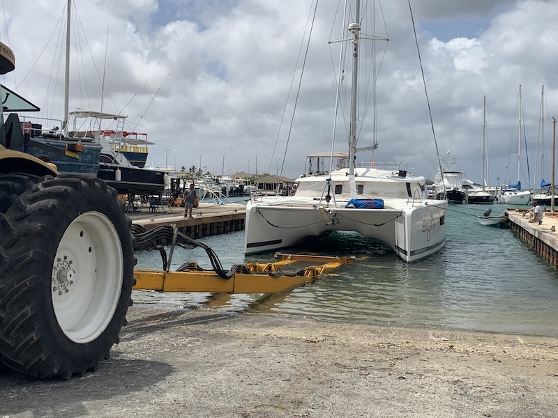
Where to go? Barbate or Gibraltar?
We left only at 11.00 in the morning. Original plan was to go to Barbate, stay over for 1 night and then sail to Gibraltar the next day. That’s also the reason we left quite late that morning at around 11.00. The sun was shining but not much wind. As usual. Sailing from Cádiz to Gibraltar Barbate is about in the middle. Just a few hours sailing. The coastline looked blue-ish again, as we had seen before at the Atlantic side of Portugal. When sailing Robbert is always looking at the weather and what it looks like, how it will develop. At this point, it looked like we were not to stay in Barbate only for 1 day but a few more. A change of weather pattern. And that’s where we decided to go straight to Gibraltar. Even though we would arrive in the dark late at night. But we did not want to be stuck in Barbate for a few days maybe. And man we made a good decision! The weather was absolutely beautiful. We did a lot of motoring and only 2 hours of sailing but still, it was really nice. We were passing Tarifa at around 20.00. Just during the golden hour! ( In photography, the golden hour is the period of daytime shortly after sunrise or before sunset, during which daylight is redder and softer than when the Sun is higher in the sky. The opposite period during twilight is the blue hour, just before sunrise or after sunset, when indirect sunlight is evenly diffused). And man did we make nice pictures? We took out the big camera’s and we made the most amazing pictures! The sun going down and just behind the lighthouse. Fabulous! The only thing you could hear for 10 minutes was click click click click …. till darkness was there. Amazing! Coming closer to Tarifa the wind started to pick up but nothing exciting or so. But here you can feel that the sea is sort of narrowing and the current will help you, or not!, and speed is going up.
Entering the MED
I found it a sort of special knowing that this is the moment you are really entering the MED. The Mediterranean Sea! We made it. Again some sort of milestone! And we did it together! Gibraltar here we come! This part of the coast can be a bit tricky weatherwise. The Gibraltar Straits is a windy alley. Strong easterlies (Levanter) or westerlies (Poniente) is normal here. You’ll often have to wait a few days for a favourable wind. Seasonal tunny nets off Barbate and Tarifa add excitement, and there’s quite a lot of commercial traffic through the traffic separation scheme of the Straights of Gibraltar. Choose your tide – it runs at up to 3kts in springs.
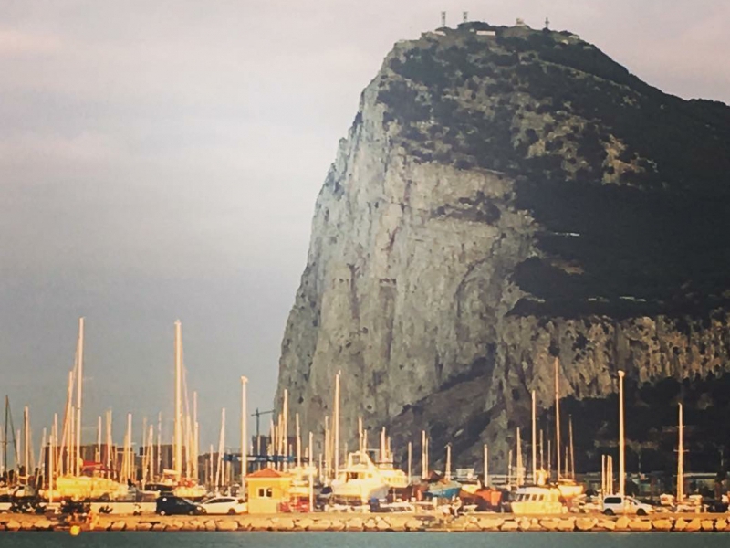
At around 21.00 it’s completely dark. Far away we could already see the lights of Gibraltar. It started raining a little but it was not cold. At 21.30 we saw the first big ships on anchor right in the Bay. When coming here the first time, in the dark, with all the lights all around, it is quite impressive!. All went fine and at 22.45 we were anchored in the Bay of La Linea. Hardly any other boats around so space enough to anchor. Our place to stay for a few days! What a trip! It feels really good when you accomplish doing something together for the first time. White wine and a good night sleep!
The Mediterranean Sea
The Mediterranean Sea is a sea connected to the Atlantic Ocean, surrounded by the Mediterranean Basin and almost completely enclosed by land: on the north by Southern Europe, on the south by North Africa and on the east by the Levant. Geological evidence indicates that around 5.9 million years ago, the Mediterranean was cut off from the Atlantic and was partly or completely desiccated over a period of some 600,000 years, the Messinian salinity crisis, before being refilled by the Zanclean flood about 5.3 million years ago. It covers an approximate area of 2.5 million km2 (965,000 sq mi), but its connection to the Atlantic (the Strait of Gibraltar) is only 14 km (8.7 mi) wide. The Strait of Gibraltar is a narrow strait that connects the Atlantic Ocean to the Mediterranean Sea and separates Gibraltar and Spain in Europe from Morocco in Africa.
The Mediterranean Sea has an average depth of 1,500 m (4,900 ft) and the deepest recorded point is 5,267 m (17,280 ft) in the Calypso Deep in the Ionian Sea. The sea is bordered on the north by Europe, the east by Asia, and in the south by Africa. It is located between latitudes 30° and 46° N and longitudes 6° W and 36° E. Its west-east length, from the Strait of Gibraltar to the Gulf of Iskenderun, on the southwestern coast of Turkey, is approximately 4,000 km (2,500 miles). The sea’s average north-south length, from Croatia’s southern shore to Libya, is approximately 800 km (500 miles). The Mediterranean Sea, including the Sea of Marmara (connected by the Dardanelles to the Aegean Sea), has a surface area of approximately 2,510,000 square km (970,000 square miles).
The sea was an important route for merchants and travellers of ancient times that allowed for trade and cultural exchange between emergent peoples of the region. The history of the Mediterranean region is crucial to understanding the origins and development of many modern societies.
Barbate
Barbate is a working fishing port with a neat little marina (fuel, showers, laundry). A useful spot to wait out a Levanter. Shops etc in a workaday town just east, which comes to life with Spanish holidaymakers in peak summer months. Barbate is a coastal town and has a long history of fishing stretching back to Roman times when fish salting was at its peak. The town has a central square, “Plaza de la Inmaculada”, flanked by the Town Hall and the Church of St. Paul. Barbate is popular with Spanish tourists in the summer but attracts few foreign visitors.
Tarifa
Tarifa is the (rather tacky) windsurfing capital of Europe, which gives a clue – 30kts is common. If you have to wait out a Levanter, it’s more comfortable to anchor in the lee of Tarifa headland, rather than alongside in the harbour, where robust fenders and chafing boards will be needed to survive. Punta de Tarifa is the southern tip of the town of Tarifa, located in the province of Cádiz, in the autonomous community of Andalusia, in Spain. The point lies on Isla de Las Palomas, a small island lying offshore and to the south of Tarifa. The island is connected to the mainland by a causeway. Punta de Tarifa is the southernmost point of the Iberian Peninsula and continental Europe. Situated at the narrowest part of the Strait of Gibraltar, it is just 14 km away from Africa. The coast of Morocco can be seen from this point. Punta de Tarifa is also the place where the Mediterranean Sea meets the Atlantic Ocean.
Statistics of the day: covered 67,7 NM, sailed 11,8 hrs offshore of which 7.0 engine hours

Leave A Comment